

This is the organization page for the H2Ohio Wetland Monitoring Program 💧
This repository is used for data quality control, data processing, internal data sharing, and code development. As H2Ohio WMP data are quality checked, audited and reviewed, it will be shared in the Environmental Data Initiative (EDI) repository. Data collected up to the 2022 water year (i.e., up to 2022-09-30) is available on EDI. Peer-reviewed documentation and resources are shared on on Zenodo or our Open Science Framework page. Questions regarding this repository can be directed to [email protected].

- 📚 To access public presentations, reports, and publications, including the Monitoring Framework and the 2022, 2023, and 2024 Annual Reports, head over to the H2Ohio WMP organization page on Zenodo or Open Science Framework (OSF).
- 📄 Fact sheets for a select number of projects are available on the LEARN website.
- 🎥 For a general overview of WMP progress, plans, and status, access the recording of our 2021, 2022, 2023, and 2024 annual update webinars.
- 📖 For an in-depth overview of progress for the H2Ohio Initiative, read through the H2Ohio Annual Reports.
- 🗺️ Interactive map of H2Ohio Wetland Projects (click on Visualize tab)
- 💰 Interactive map with H2Ohio Project Funding and Metrics (click on Visualize tab)
- ⌛ Chronologs at H2Ohio Wetland Projects
- 💧 CrowdHydrology at H2Ohio Wetland Projects
H2Ohio is a data-driven, collaborative, and comprehensive water quality initiative that started in 2019 under Governor Mike DeWine to strategically address Ohio's water quality issues, including harmful algal blooms (HABs) in Lake Erie.
One of H2Ohio's targeted priorities is to decrease nutrient loading in surface waters, especially to the Western Basin of Lake Erie. The initiative identified 10 best practices that prevent and mitigate nutrient runoff, which have been gradually implemented in collaboration with the Ohio Department of Agriculture (ODA), Ohio Department of Natural Resources (ODNR), Ohio Environmental Protection Agency (OEPA), and other partners.
One of the best practices identified is to create, restore, and enhance wetlands in strategic areas to retain and process nutrient inputs and decrease its burden downstream. The ODNR, responsible for the implementation and oversight of this practice, has enlisted the Lake Erie and Aquatic Research Network (LEARN) to implement the H2Ohio Wetland Monitoring Program (WMP).
The goal of the WMP is to directly measure the nutrient removal function of these created, restored, and enhanced wetlands by assessing its ability to retain and process nutrients. These data will help inform future investment and decisions regarding wetland placement, design, and management practices.
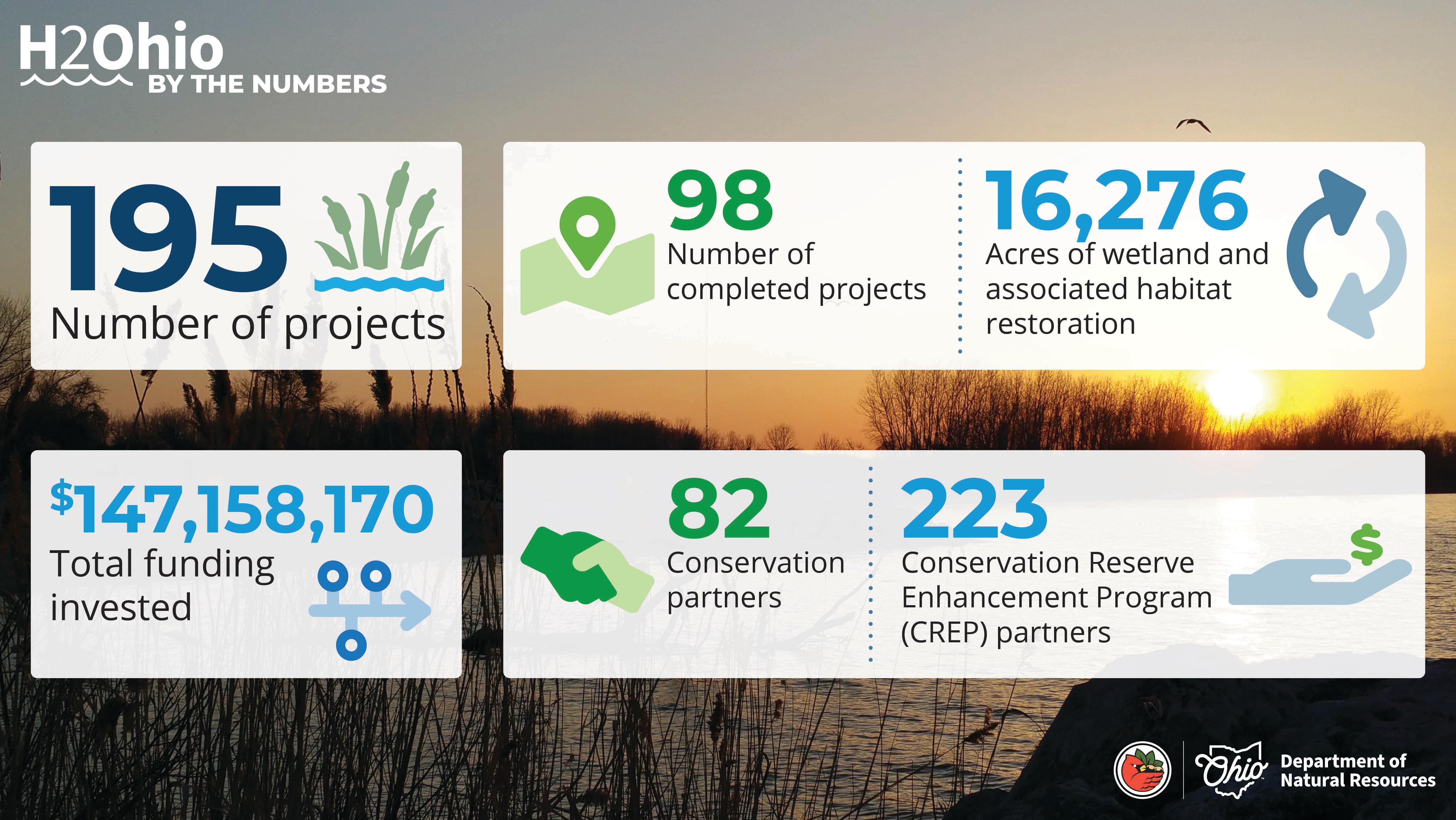
As of 2025, the ODNR has identified over 195 wetland projects all throughout Ohio, several of which have been routinely monitored since construction completion.
